Maps & Data
 An online tool enables partners to ask multiple questions about the underlying data, such as why is this place important and what priorities are within this area.
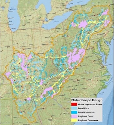
A gallery of maps from the multiple phases of the NatureScape Conservation Design, highlighting regional cores, connectors, and other important areas of conservation.
Data displaying the spatial extent of the conservation design elements from the Appalachian NatureScape project is available via download.
The "Interactive Conservation Planning and Design Phase 1 for the Appalachian LCC" report provides an executive summary and management recommendations that detail the major findings and conclusion that came out of this research. The report then digs into more detailed information about the research, which can be found within the sections of background, process of assembling and interacting with technical teams for priority resource selection, priority resources used for conservation planning, modeling outputs, framework for cultural resource mapping, and conclusion.


